ZEE-GEAR Adjuster

Precision pole-mount for RTK × 360° walk-through photogrammetry

A camera mount that puts your 360°camera and RTK-GNSS antenna on the same vertical axis — zero horizontal offset. That single geometric fact is what lets RTK camera positions georeference a survey directly, with no ground control points. Designed, field-proven and shipped by a licensed land-survey office in Japan that uses it every week in cadastral work.

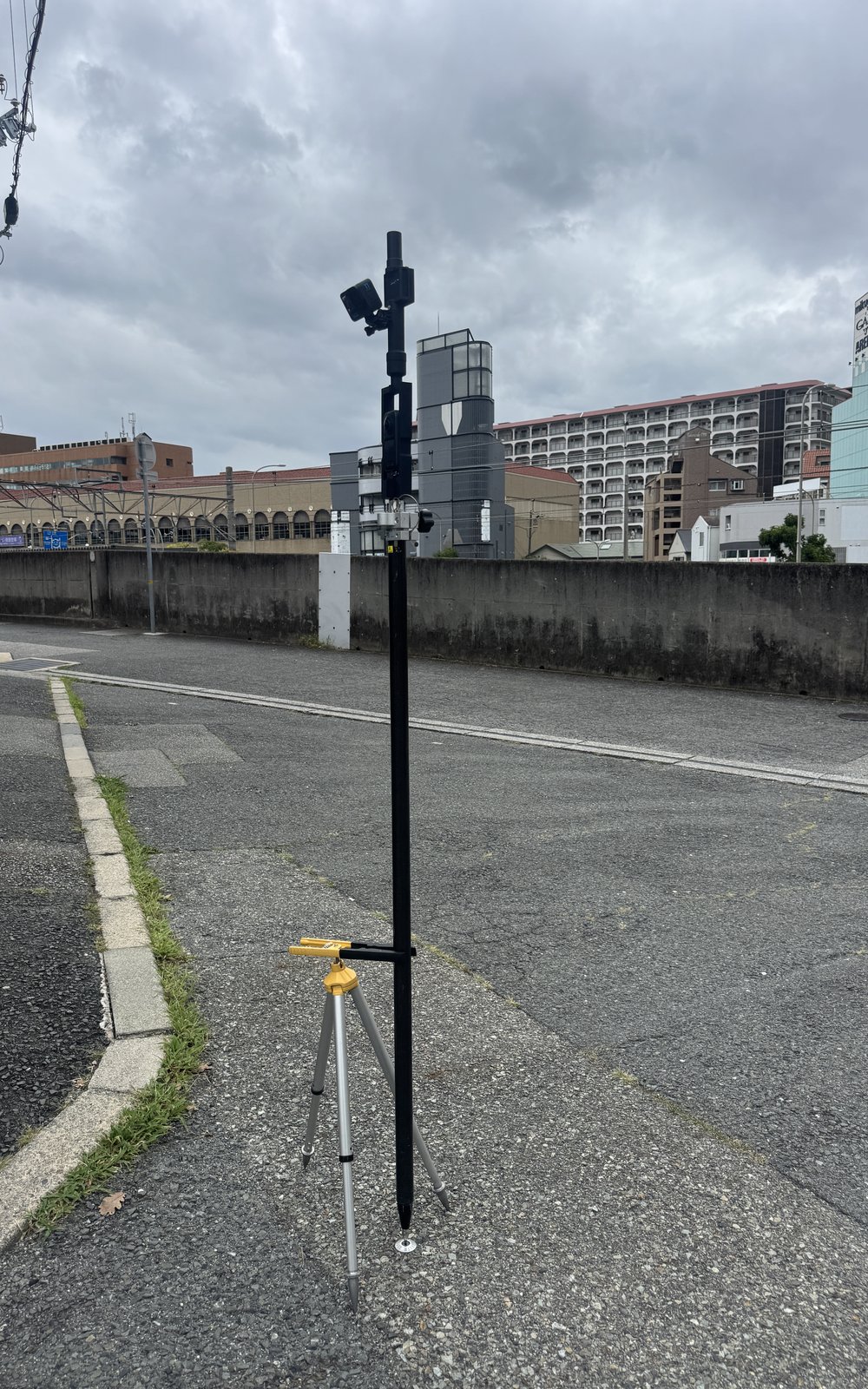
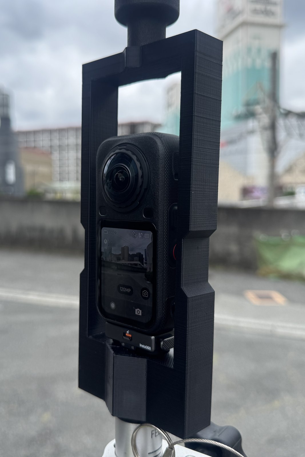
Insta360 X6 mounted in the ZEE-GEAR Adjuster frame on a survey pole

In use: Insta360 X6 mounted in the Adjuster on a survey pole (camera not included)

Photos show the Adjuster in use with a camera, RTK-GNSS receiver and pole — those items are sold separately and are not included. Click a photo to enlarge.
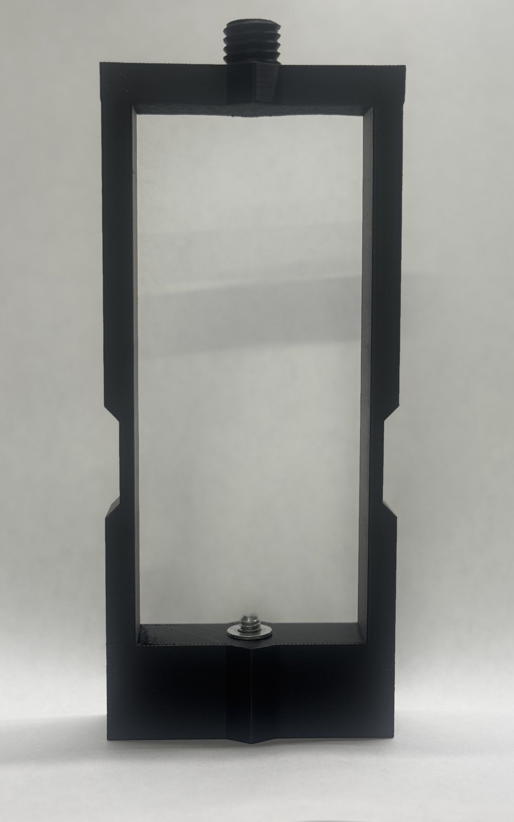
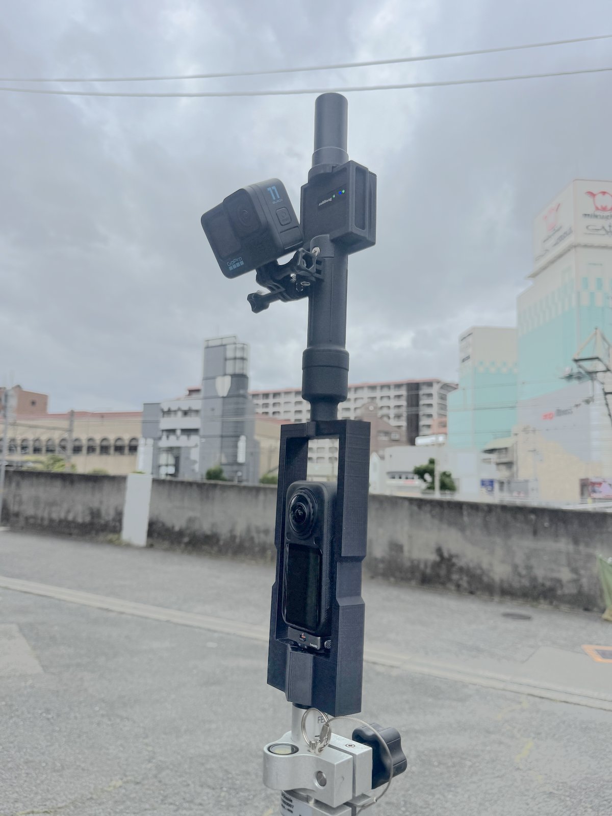
ZEE-GEAR Adjuster frame - the product itself Full rig with RTK receiver and optional GoPro side-mount Full rig standing on site with bipod
ZEE-GEAR Adjuster Camera pole-mount adapter — 3D-printed engineering plastic, made in Japan
JPY 22,800tax-free export price
What's included: the Adjuster (mount) only.
The 360°camera, RTK-GNSS receiver / antenna and survey pole shown in the photos are NOT included — this product is the precision mount that connects them.
  • Zero horizontal offset. Antenna phase center and camera sit on one vertical axis, so the RTK position is the camera position.
  • Fits RICOH THETA X and Insta360 X4 / X5 / X6. Standard 5/8-inch survey-pole thread.
  • Keep the pole vertical and the camera is level — the capture-quality conditions are met just by holding it naturally.
  • Field-proven. The exact model we use in our own cadastral surveys in Kyoto, Tokyo and Hyogo.
Order now — ships worldwide

Secure card checkout by Stripe. Prices in JPY — your card issuer converts to your local currency. Select the shipping option for your region at checkout.
What it enables

Walk, don't stake

Walk the site with the pole. Every video frame gets an RTK coordinate through time synchronization — no ground control points to place, measure or paint.

Ground orthos where drones can't fly

Under trees, eaves and in narrow lanes: ground-level 360°imagery produces orthoimagery, point clouds and DEMs of the places aerial mapping misses.

Survey-grade geometry

With RTK-Fix positions and stop-point calibration, open-sky residuals reach the 0.1–0.2 m class — from a walk.

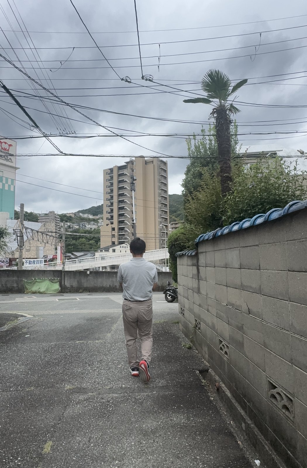
Surveyor walking a site with the ZEE-GEAR rig
Capture is just walking the site — the rig keeps geometry honest.
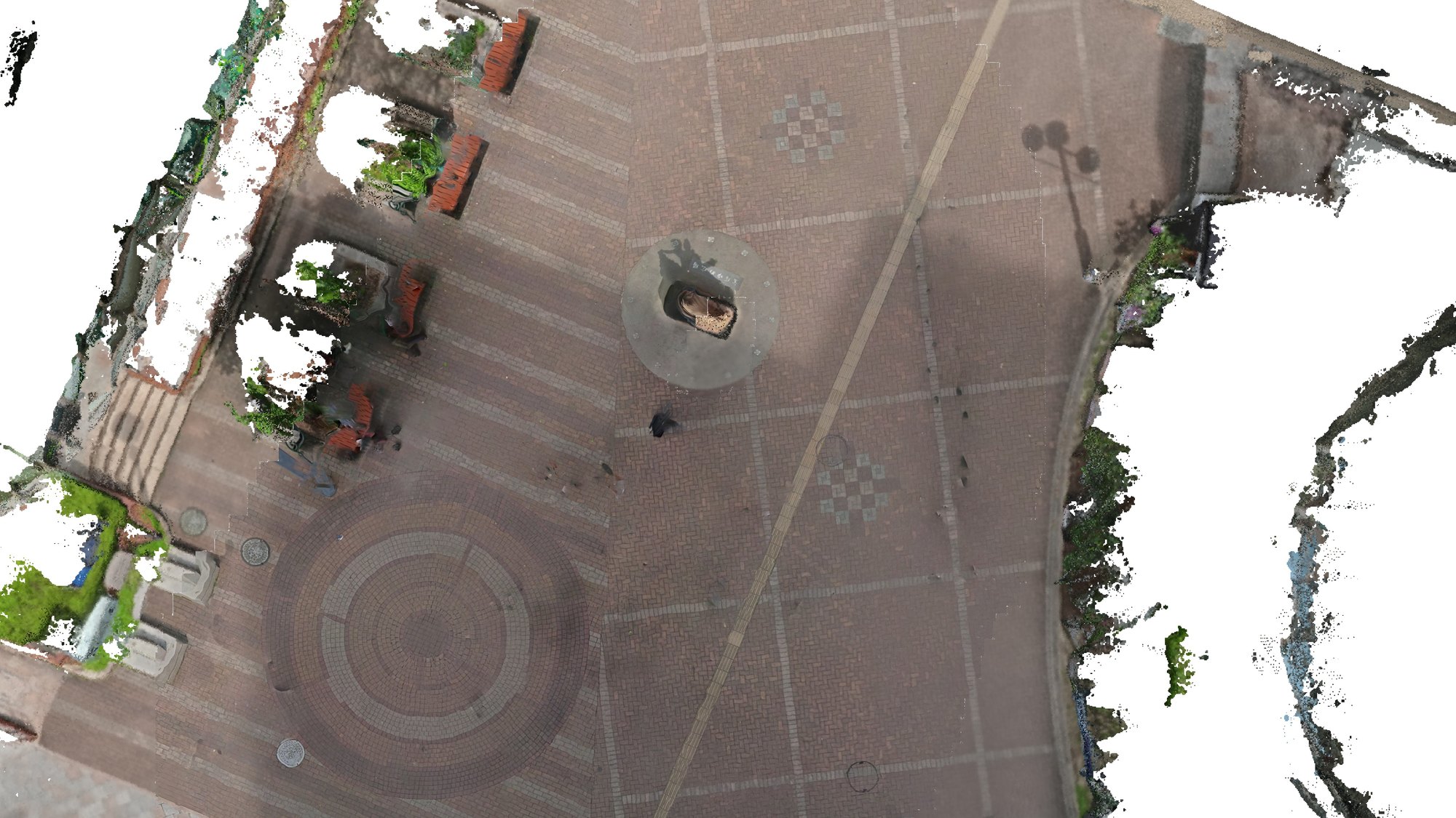
Ground orthoimagery of a station plaza produced from a 3m40s walk-through capture
Ground orthoimagery from a 3 min 40 s walk (Takarazuka station plaza, Japan, Sep 2026). Sharp centre = within ±3 m of the walked path; grainy outer = point-cloud ortho; white = not observed. About 7 mm/pixel.

Shipping — Japan Post EMS, tracked

RegionShipping fee
China / South Korea / TaiwanJPY 2,500
Other AsiaJPY 3,500
Europe / Oceania / CanadaJPY 4,800
Central & South America / Africa / Middle EastJPY 5,500

Dispatched within 3 business days of payment; delivery typically 4–10 days. Tracking number sent by e-mail.

Please note:
  • United States — currently not available. US-bound parcels require pre-paid customs processing which we are preparing separately. Contact us if you are interested.
  • Import duties and taxes in the destination country are the responsibility of the recipient (DAP). Customs declaration: camera mount adapter of plastics, HS 3926.90, origin Japan.
  • We verify your address before dispatch and will contact you if the selected shipping region does not match.
  • Defective items are replaced at our cost. Otherwise returns are not accepted on international orders.

About the software — DrogRTK360

The companion app and PC tools (DrogRTK360) turn the walk into georeferenced deliverables: ground orthoimagery, point clouds and DEMs. Time-synchronized RTK camera positions provide the georeferencing; stop-point self-calibration keeps the time sync honest.

The software is currently sold in Japan only — the UI is Japanese and it is built around Japan's GNSS correction infrastructure (NTRIP/VRS). The Adjuster itself is software-independent and works with any RTK workflow that uses a survey pole.

Interested in DrogRTK360 outside Japan? We are open to discussing GNSS correction compatibility and language support for your region — contact us.

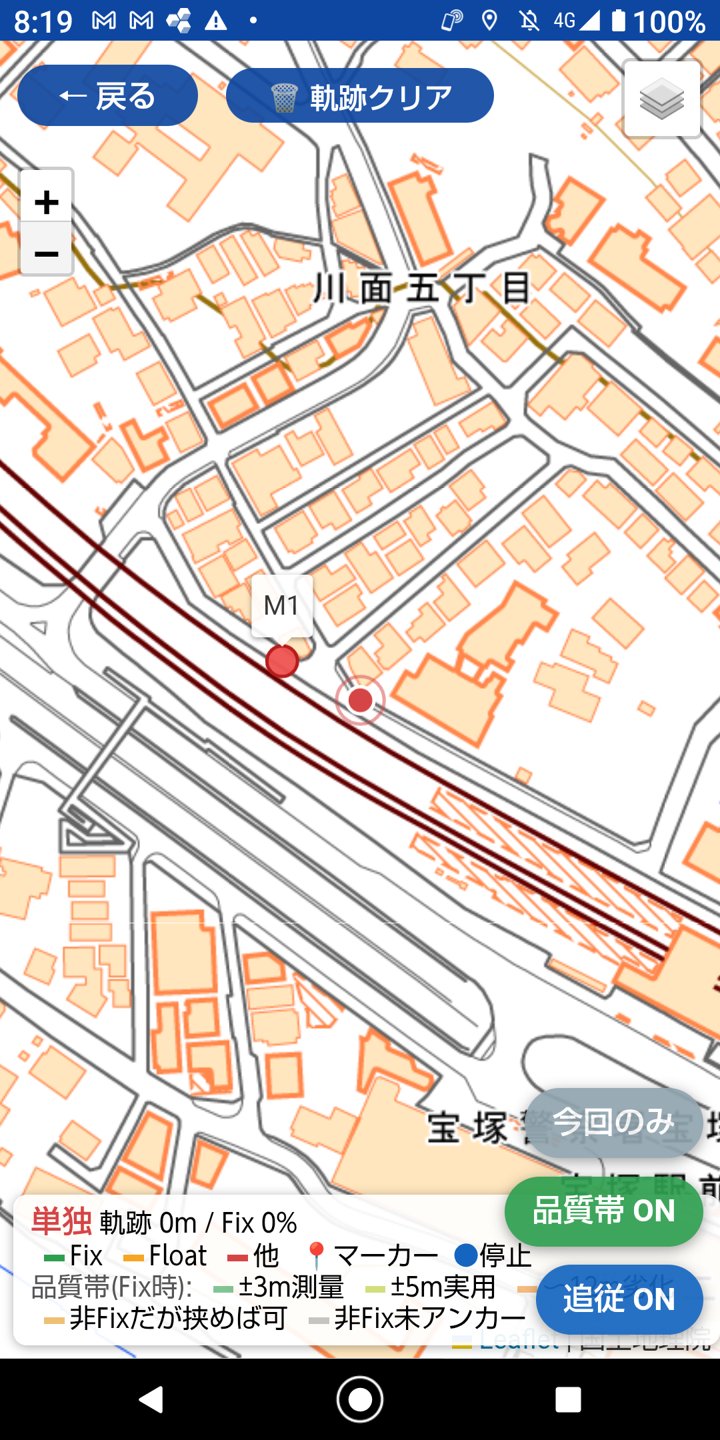
DrogRTK360 app showing live track map with RTK fix quality

Live coverage map with RTK fix-quality colouring — one part of the capture-assurance workflow.

Seller

Fujii Kazuaki Land and House Investigator Corporation (company profile)
5-10-2 Kawamo, Takarazuka, Hyogo 665-0842, Japan
Licensed Land and House Investigators (Tochi-Kaoku-Chosashi) — cadastral surveying and property-boundary registration.
E-mail: fzeeplus@gmail.com (English / 日本語)